What is new in Version 3?
MAP + version 3 has been under development since August 2019 and is now "ready for shipping". The innovations are extensive - it's not just a new version, it's a new generation of software:
- Significantly simplified configuration with a new user administration that supports portals, profiles and groups
- New Modules (MAP+ Enterprise):
- Support of lists and geographical selections as well as their combination. In addition selected data can be exported in different formats
- Nested forms with options for data capture on tables and linked tables, data upload of documents, videos etc.
- PDF reports with map integration and the possibility of geographic analysis such as overlays
- Advanced Editing for tailored applications
Thanks to the power of the new modules and their easy configuration, almost any kind of modules can be realized in a short time and without programming knowledge. Examples from ongoing projects:
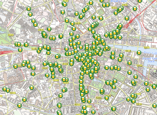
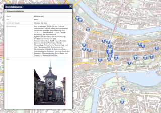
- Tree cadaster
- Sewage
- Lease land management
- Determination of compensation for winter sports (cross-country trails, ski slopes, etc.)
- Property sheet
- Document management
- Signaling

Simplified configuration with a new user administration
Terms
Terms such as profiles, groups, roles etc. always cause misunderstandings. Here are the terms we use for MAP+:
- Owner:
- Owner of an application
- Top level or main directory
- Example: Province
- Portals:
- Portals of the owner
- Example: Subdirectories of "Province", i.e. municipalities
- Profiles:
- Profiles of a portal
- Examples: "public", "restricted"
- Groups (new in V3):
- User groups
- Examples: different "restricted" groups: intranet, extranet, office_x, office_y
New structure of the MAP + configuration
The structure of the configuration files has been changed so that the workload for setting up sites is minimized:
- Configurations that apply to everyone are defined at the owner level. For example all layer and query definitions. If, for example, a layer is added, it only has to be defined at a single location. The assignment is made at portal, profile and group level.
- At the other levels, only different configurations are defined.
- Layer definition and layer structure are now managed separately. This allows you to assign layers and queries at every level with minimal effort.
- Configuration of PDF printing only if it differs from the layer definition.
- National Language Support (NLS) is also defined centrally at the owner level. Only different definitions on the other levels.
New User Administration
The user administration has been completely rewritten and provided with a new user interface:
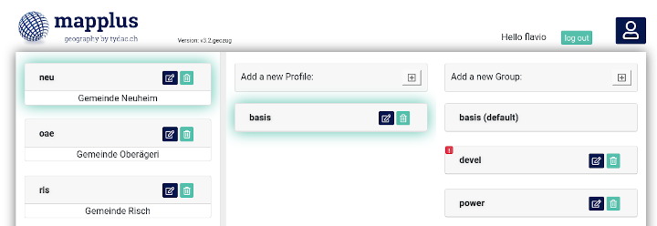
Explanations:
- On the left are the individual portals, in the example municipalities
- Profiles are shown in the middle
- On the right the groups
- Existing portals, profiles and groups can be imported
- Users can be configured as follows:
- Super users: can see all portals, profiles, groups and can administer them
- Administrators: Can administer portals assigned to them and create users
- Users: Can see portals, profiles and groups assigned to them

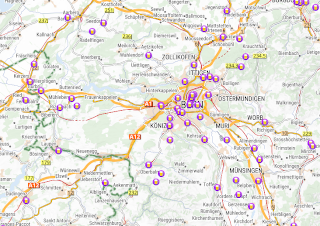
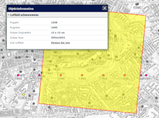
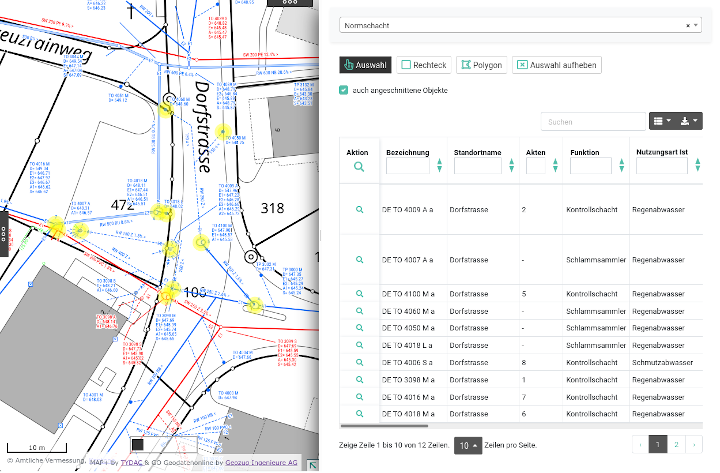
Lists and geographical selections
This enables database tables and joins to be published as lists. The functionality includes:
- Filter by database content
- Smart boolean filter with three states: no filter, true, false
- Search function across all fields
- Geographic selection: selection (toggle on / off), rectangle, polygon. Also switch the option "only intersected objects" on or off
- Any combination of filters and geographic selection
- Clear selection: clears all filters and selections
- Export function: JSON, XML, CSV, TXT, SQL, MS Excel
- Selection of the fields to be displayed
The configuration is done via Json files and is a uncomplicated and straightforward.
Example:

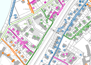
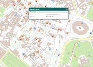
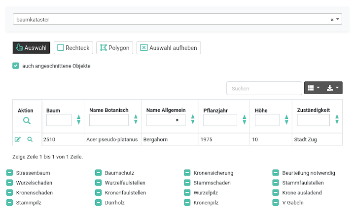
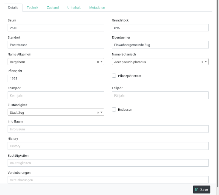
Forms
Along with the lists, this functionality turns MAP + into a sophisticated database application:
- Freely configurable with database tables, joins (1: n), views etc.
- Any number of tabs
- Freely configurable editing for user groups
Example (tree cadastre):
Selection from the list:
Form:

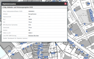
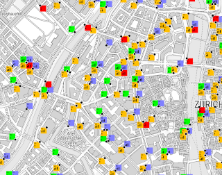
PDF Reports
With this new module, not only maps can be printed as PDF, but also any combination of maps, database entries and geographical overlays. Examples:
- Tree cadastre with extensive information
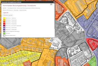
- Property sheet with live overlay of addresses, land cover and planned objects
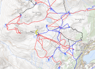
- Determination of compensation for Davos winter sports: with live overlays of cross-country trails and winter hiking trails based on width, ground cover, land and, where applicable, land managers. The compensation is then calculated based on the results of the overlay.

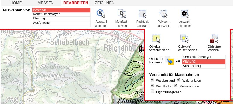
Advanced Editing
The editing options of MAP+ based on PostGIS have been expanded in such a way that it does not have to hide from any desktop GIS. Advanced editing are sometimes very complex, tailor-made solution (as you can see in the example below).
- Lines: Split lines
- Polygons: Digitizing of multipolygons, donut polygons, clipping with adjacent polygons, splitting, merging, copying
- Cross-layer copying of existing objects for further processing
- Multigeometry: Points, lines and areas in the same table
Example: